Leicestershire
Udseende

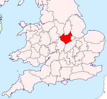
Leicestershire (forkortes Leics) er et ceremonielt grevskab i East Midlands.
Administrativ opdeling
[redigér | rediger kildetekst]Grevskabet består af City of Leicester, der er en selvstyrende kommune og det administrative grevskab, der delt i syv kommuner (districts), som hører under grevskabsrådet (Leicestershire County Council).
Geografi
[redigér | rediger kildetekst]Grevskabet grænser op til Nottinghamshire mod nord, Lincolnshire mod nordøst, Rutland mod øst, Northamptonshire mod sydøst, Warwickshire mod sydvest, Staffordshire mod vest of Derbyshire mod nordvest.
Byer
[redigér | rediger kildetekst]Seværdigheder
[redigér | rediger kildetekst]- Ab Kettleby Manor

- Abbey Pumping Station

- Ashby-de-la-Zouch Canal

- Ashby Castle


- Arnesby May Fayre
- The Battlefield Line

- Beacon Hill


- Beaumanor Hall


- Belgrave Hall & Gardens


- Belvoir Castle

- Bosworth Battlefield

- Bradgate Park

- Brampton Valley Way (former railway path to Northampton)

- Breedon Hill (Iron Age hill fort and Saxon church)


- Bruntingthorpe Aerodrome and proving ground
- Burrough Hill Iron Age Hill Fort

- Charnwood Forest


- Charnwood Museum

- Cold Overton Hall

- Donington le Heath Manor House Museum


- Donington Park and the Donington Grand Prix Collection museum

- East Midlands Airport
- Eyebrook Reservoir

- Fosse Shopping Park
- Foxton Locks


- Great Central Railway (heritage railway)

- Grace Dieu Manor

- Grace Dieu Priory


- Groby Old Hall

- Harborough Museum

- High Cross (Roman settlement)

- Kirby Muxloe Castle

- Launde Abbey

- Leicester Abbey Park
- Leicester Abbey ruins


- Leicester Castle


- Leicester Cathedral

- Leicester Guildhall

- Leicester Jewry Wall Museum

- Leicester New Walk (Regency promenade following the Roman Via Devana)

- Leicester New Walk Museum & Art Gallery

- Lowesby Hall

- Lutterworth (historic market town)
- Lutterworth Church (home of the Lutterworth Wall Paintings)

- Mallory Park
- Market Bosworth (historic market town)
- Market Harborough (historic market town)
- Melton Mowbray (historic market town)
- Melton Carnegie Museum

- Moira Furnace

- Mount St. Bernard Abbey

- National Space Centre

- The National Forest and Conkers


- Nevill Holt Hall

- Newark Houses Museum


- Quenby Hall

- Quorn Hall

- Shenton Hall

- Snibston Discovery Museum

- Stanford Hall

- Stoney Cove the National Diving Centre
- Stoneywell


- Stapleford Miniature Railway

- Stapleford Park

- Swithland Reservoir

- Swithland Wood


- Twinlakes Theme Park

- Twycross Zoo

- Ulverscroft Priory[2]


- University of Leicester Botanic Garden
- Watermead Country Park

- Wigston Framework Knitters Museum[3]

- Wistow Hall

Referencer
[redigér | rediger kildetekst]- ^ Ref for table. "Figure 1: Explore population characteristics of individual BUAs". Hentet 4. april 2024.
- ^ "Ulverscroft". Charnwood Borough Council. 26. juni 2006. Arkiveret fra originalen 26. juni 2006.
- ^ "Wigston Framework Knitters Museum, Leicester". Knitting Together. 23. juli 2005. Arkiveret fra originalen 23. juli 2005.
Eksterne henvisninger
[redigér | rediger kildetekst]| Spire Denne artikel om Englands geografi er en spire som bør udbygges. Du er velkommen til at hjælpe Wikipedia ved at udvide den. |
52°43′00″N 1°11′00″V / 52.716666666667°N 1.1833333333333°V
