
Fil:Location map Bonaire.png

Størrelse af denne forhåndsvisning: 568 × 600 pixels. Andre opløsninger: 227 × 240 pixels | 455 × 480 pixels | 739 × 780 pixels.
Fuld opløsning (739 × 780 billedpunkter, filstørrelse: 140 KB, MIME-type: image/png)
|
|
Denne fil er fra Wikimedia Commons. Beskrivelsen af filen fra Commons er gengivet nedenfor. |
| Beskrivelse |
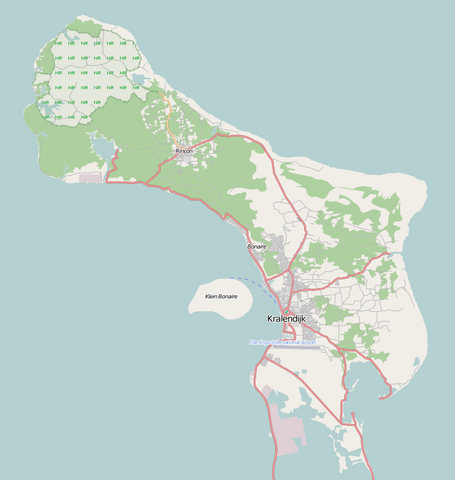
English: Map of Bonaire for pin
Geographic limits of the map:
Denne fil er udgivet under Creative Commons Navngivelse – Del på samme vilkår 2.0 Generisk-licensen.
|
| Dato | |
| Kilde | Maps for free |
| Forfatter | Dr. Blofeld |
Filhistorik
Klik på en dato/tid for at se filen som den så ud på det tidspunkt.
| Dato/tid | Miniaturebillede | Dimensioner | Bruger | Kommentar | |
|---|---|---|---|---|---|
| nuværende | 2. maj 2011, 12:58 | | 739 × 780 (140 KB) | Blofeld Dr. | {{Information |Description ={{en|1=t}} |Source =t |Author =t |Date =t |Permission = |other_versions = }} |
Filanvendelse
Den følgende side bruger denne fil:
Global filanvendelse
Følgende andre wikier anvender denne fil:
- Anvendelser på ar.wikipedia.org
- Anvendelser på bg.wikipedia.org
- Anvendelser på bs.wikipedia.org
- Anvendelser på ceb.wikipedia.org
- Plantilya:Location map Bonaire
- Signal Hill
- Green Island
- Flat Point
- Castle Hill
- North Point
- Little Island
- Sugar Loaf
- Southeast Point
- Santa Maria (pagklaro)
- Angola (pagklaro)
- Camia (pagklaro)
- Pig Rock
- Montana
- Lac
- Rincón
- Peak Hill
- Kates Hill
- Fort Hill
- Tent Point
- Little Mountain
- Grey Hill
- Needle Rocks
- Pilot Hill
- Bunker Hill
- Ceru Pretu
- Oranjestad
- Westpunt
- Ceru Grandi
- Seroe Grandi
- Well’s Gut
- Wash Gut
- Hellsgate
- Troy
- The Bottom
- Soledad
- Soldiers Gut
- Smith Gut
- Sint Eustatius
- Saint John’s Hill
- Saba Island
- Saba (pagklaro)
- Rancho
- Pisga
- Paris Hill
- Montaña
Vis flere globale anvendelser af denne fil.