Fil:Kephalonia.png
Udseende

Størrelse af denne forhåndsvisning: 688 × 600 pixels. Andre opløsninger: 275 × 240 pixels | 551 × 480 pixels | 881 × 768 pixels | 1.131 × 986 pixels.
Fuld opløsning (1.131 × 986 billedpunkter, filstørrelse: 1,11 MB, MIME-type: image/png)
Filhistorik
Klik på en dato/tid for at se filen som den så ud på det tidspunkt.
| Dato/tid | Miniaturebillede | Dimensioner | Bruger | Kommentar | |
|---|---|---|---|---|---|
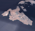
| nuværende | 30. jul. 2006, 17:15 |  | 1.131 × 986 (1,11 MB) | AlMare | {{Bilderwerkstatt}} Sharpened + more contrast, -- ~~~~ ---- The Greek islands Kephalonia and Ithaka, produced with NASA World Wind {{PD-WorldWind}} Category:Satellite images of islands Category:Satellite pictures of Greece Category:Kefalonia |
| 12. jun. 2005, 16:26 |  | 1.131 × 986 (743 KB) | WL~commonswiki | The Greek islands Kephalonia and Ithaka, produced with NASA World Wind {{PD-USGov-NASA}} |
Filanvendelse
Den følgende side bruger denne fil:
Global filanvendelse
Følgende andre wikier anvender denne fil:
- Anvendelser på ar.wikipedia.org
- Anvendelser på arz.wikipedia.org
- Anvendelser på bg.wikipedia.org
- Anvendelser på ca.wikipedia.org
- Anvendelser på de.wikipedia.org
- Anvendelser på el.wikipedia.org
- Anvendelser på en.wikipedia.org
- Anvendelser på es.wikipedia.org
- Anvendelser på fr.wikipedia.org
- Anvendelser på hr.wikipedia.org
- Anvendelser på hu.wikipedia.org
- Anvendelser på hy.wikipedia.org
- Anvendelser på hyw.wikipedia.org
- Anvendelser på it.wikipedia.org
- Anvendelser på it.wikivoyage.org
- Anvendelser på jv.wikipedia.org
- Anvendelser på no.wikipedia.org
- Anvendelser på pl.wikipedia.org
- Anvendelser på pt.wikipedia.org
- Anvendelser på simple.wikipedia.org
- Anvendelser på sv.wikipedia.org
- Anvendelser på uk.wikipedia.org
- Anvendelser på zh.wikipedia.org


