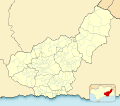
Fil:Granada-loc.svg
Udseende

Størrelse på denne PNG forhåndsvisning af denne SVG-fil: 512 × 452 pixels. Andre opløsninger: 272 × 240 pixels | 544 × 480 pixels | 870 × 768 pixels | 1.160 × 1.024 pixels | 2.320 × 2.048 pixels.
Fuld opløsning (SVG fil, basisstørrelse 512 × 452 pixels, filstørrelse: 490 KB)
Filhistorik
Klik på en dato/tid for at se filen som den så ud på det tidspunkt.
| Dato/tid | Miniaturebillede | Dimensioner | Bruger | Kommentar | |
|---|---|---|---|---|---|
| nuværende | 2. jan. 2023, 21:52 |  | 512 × 452 (490 KB) | Lopezsuarez | Reverted to version as of 14:26, 6 April 2022 (UTC) |
| 2. jan. 2023, 21:51 |  | 512 × 452 (490 KB) | Lopezsuarez | Reverted to version as of 16:02, 9 December 2010 (UTC) | |
| 6. apr. 2022, 15:26 |  | 512 × 452 (490 KB) | Lopezsuarez | Reverted to version as of 16:04, 9 December 2010 (UTC) | |
| 4. apr. 2022, 12:38 |  | 512 × 452 (1,55 MB) | NACLE | quito el marco | |
| 4. apr. 2022, 12:35 |  | 512 × 452 (1,57 MB) | NACLE | añado nuevos municipios | |
| 9. dec. 2010, 17:04 |  | 512 × 452 (490 KB) | Miguillen | defecto | |
| 9. dec. 2010, 17:02 |  | 512 × 452 (490 KB) | Miguillen | colores y mosca según convención | |
| 14. aug. 2010, 16:27 |  | 512 × 452 (390 KB) | Miguillen | marco | |
| 20. maj 2010, 11:03 |  | 512 × 452 (356 KB) | Miguillen | efecto trazo | |
| 19. maj 2010, 11:21 |  | 512 × 452 (354 KB) | Miguillen | == {{int:filedesc}} == {{Information |Description={{en|Location map of Province of Granada}} Equirectangular projection, N/S stretching 130 %. Geographic limits of the map: * N: ° N * S: ° N * W: ° O * E: ° O {{es|Mapa |
Filanvendelse
Den følgende side bruger denne fil:
Global filanvendelse
Følgende andre wikier anvender denne fil:
- Anvendelser på ar.wikipedia.org
- Anvendelser på ba.wikipedia.org
- Anvendelser på ceb.wikipedia.org
- Anvendelser på de.wikipedia.org
- Anvendelser på en.wikipedia.org
- Sexi (Phoenician colony)
- Órgiva
- Bubión
- Motril
- Guadix
- Alhama de Granada
- Salobreña
- Jabalcón
- Santa Fe, Granada
- Albuñán
- Benalúa de las Villas
- Castril
- Las Gabias
- La Zubia
- Loja, Granada
- Veleta (Sierra Nevada)
- Galera, Granada
- Battle of Moclín (1280)
- Module:Location map/data/Spain Province of Granada/doc
- Torrenueva Costa
- Module:Location map/data/Spain Province of Granada
- Fornes, Granada
- Játar
- Anvendelser på eo.wikipedia.org
Vis flere globale anvendelser af denne fil.
