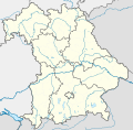
Fil:Bavaria location map.svg
Udseende

Størrelse på denne PNG forhåndsvisning af denne SVG-fil: 608 × 600 pixels. Andre opløsninger: 243 × 240 pixels | 487 × 480 pixels | 779 × 768 pixels | 1.038 × 1.024 pixels | 2.077 × 2.048 pixels | 867 × 855 pixels.
Fuld opløsning (SVG fil, basisstørrelse 867 × 855 pixels, filstørrelse: 738 KB)
Filhistorik
Klik på en dato/tid for at se filen som den så ud på det tidspunkt.
| Dato/tid | Miniaturebillede | Dimensioner | Bruger | Kommentar | |
|---|---|---|---|---|---|
| nuværende | 19. nov. 2009, 18:22 |  | 867 × 855 (738 KB) | Alexrk2 | fixed boundaries, rivers; adjusted map projection; colors for internal divisions |
| 28. mar. 2009, 21:01 |  | 867 × 855 (1,05 MB) | TUBS | #corrected 4 mistakes (lake margins (pasted to foreground), RegBez and counties around TIR (splited area in two counties and corrected RegBez border), County of Munich (merged), Merged an (to me right know unknown) county north of Nuremberg. #moved all gr | |
| 28. jan. 2009, 10:32 |  | 867 × 855 (1,45 MB) | TUBS | {{Information |Description= |Source= |Date= |Author= |Permission= |other_versions= }} | |
| 28. jan. 2009, 01:20 |  | 867 × 855 (1,45 MB) | TUBS | {{Information |Description= |Source= |Date= |Author= |Permission= |other_versions= }} | |
| 27. jan. 2009, 01:11 |  | 867 × 855 (1,46 MB) | TUBS | {{Information |Description= |Source= |Date= |Author= |Permission= |other_versions= }} | |
| 27. jan. 2009, 00:20 |  | 867 × 855 (1,5 MB) | TUBS | {{Information |Description= |Source= |Date= |Author= |Permission= |other_versions= }} | |
| 26. jan. 2009, 12:38 |  | 867 × 855 (1,51 MB) | TUBS | == Summary == {{Information |Description= {{de|Positionskarte Hessen, Deutschland. Geographische Begrenzung der Karte:}} {{en|Location map Bavaria, Germany. Geographic limits of the map:}} * N: 50.6303000° N * S: 47.26618 | |
| 26. jan. 2009, 12:24 |  | 867 × 855 (1,52 MB) | TUBS | == Summary == {{Information |Description= {{de|Positionskarte Hessen, Deutschland. Geographische Begrenzung der Karte:}} {{en|Location map Bavaria, Germany. Geographic limits of the map:}} * N: 50.6303000° N * S: 47.26618 |
Filanvendelse
Den følgende side bruger denne fil:
Global filanvendelse
Følgende andre wikier anvender denne fil:
- Anvendelser på af.wikipedia.org
- Anvendelser på als.wikipedia.org
- Anvendelser på ar.wikipedia.org
- Anvendelser på ast.wikipedia.org
- Anvendelser på azb.wikipedia.org
Vis flere globale anvendelser af denne fil.


